18 Maps Of The United States That Made Us Say 'Whoa'
Ranked By
328.6K votes
79.3K voters
Voting Rules
Vote up the maps that surprise you by breaking down America in uniquely illustrative ways.
America. It's so much more than chants of "USA! USA! USA!" can possibly capture. It's a diverse empire of more than 327 million people living often radically different star-spangled lives in the land of the free. In addition to helping navigate from sea to shining sea, maps can help convey just how magnificently multifarious this great nation really is. These are the most compelling maps of the United States of America available on r/mapp*rn, and you can vote up the ones that blow your red, white, and blue mind.
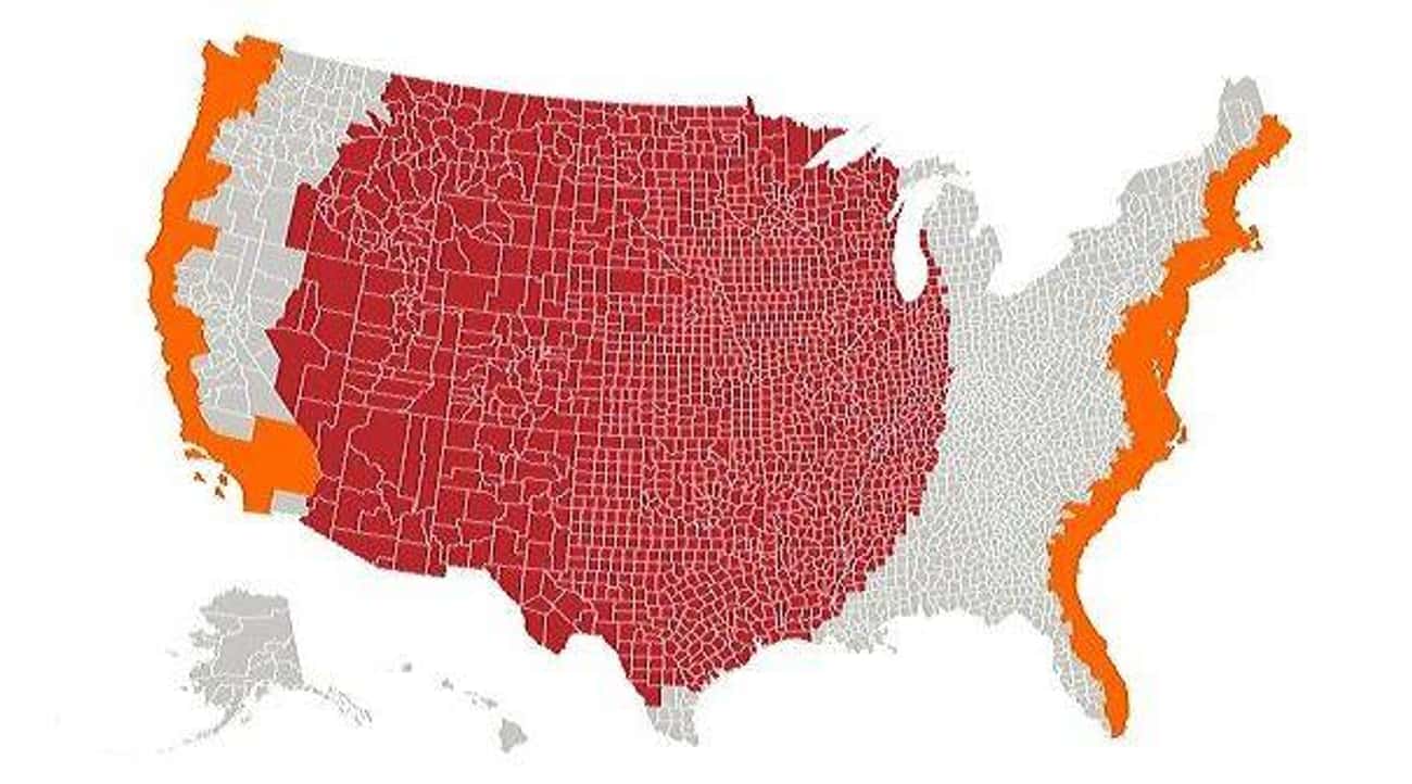
1. The Red Area Features A Total Population Greater Than The Grey
Photo: u/lex52485 / Reddit2. The Red And Orange Sections Have Equal Populations
Photo: u/Cogo5646 / Reddit3. Tree Cover, Visualized
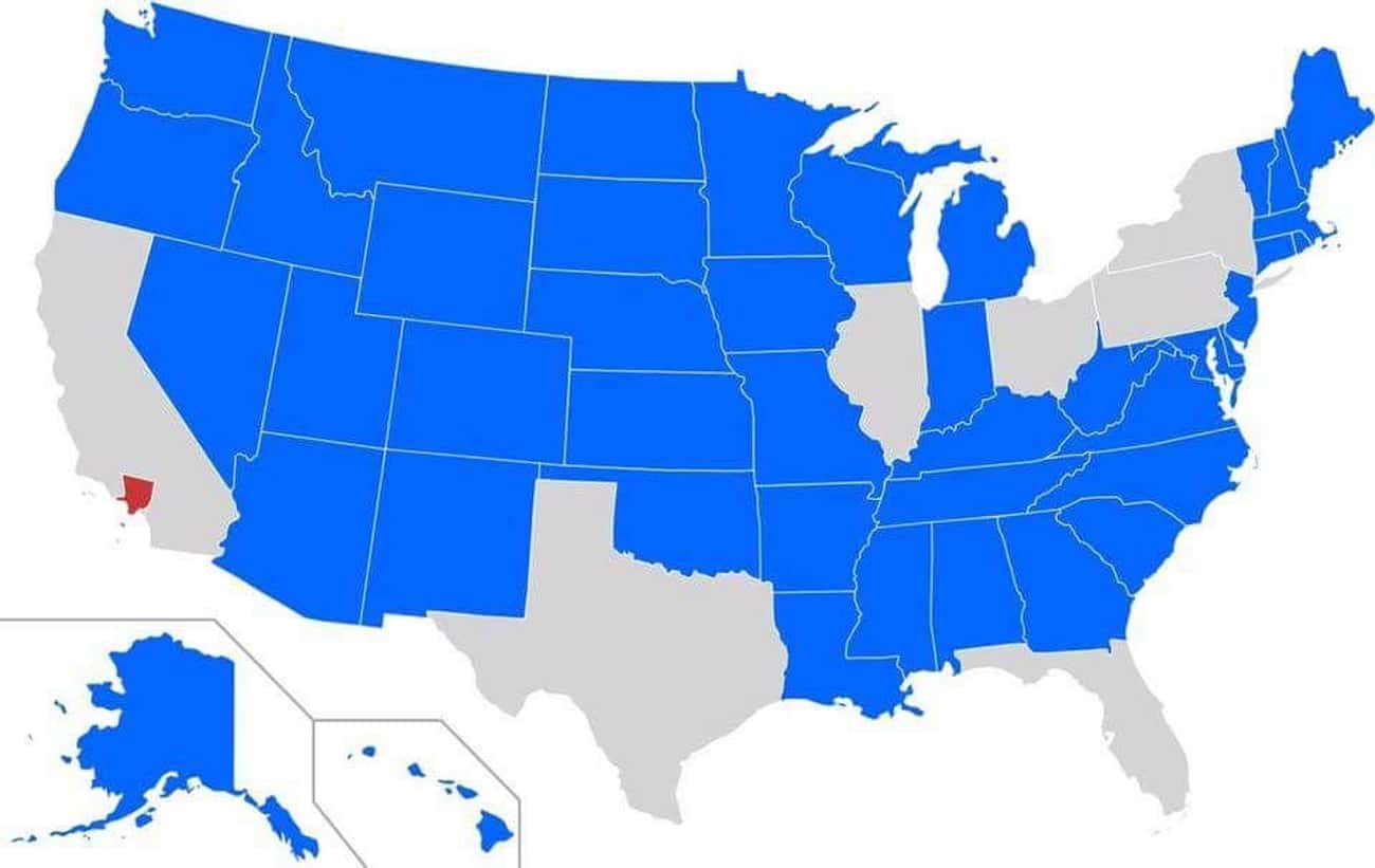
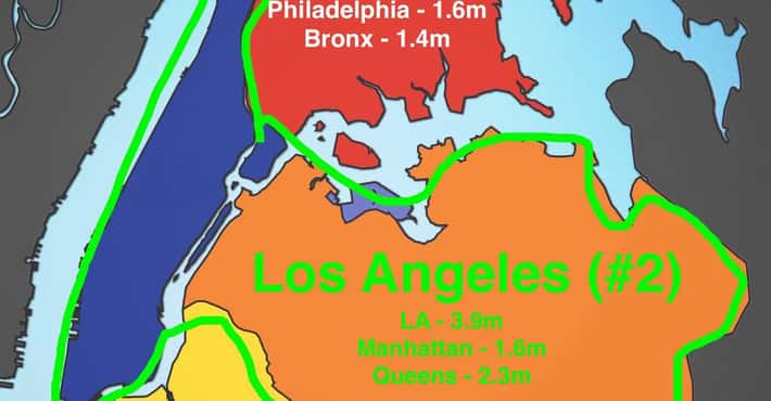
Photo: u/DrWendigo / Reddit4. Blue States Have A Smaller Population Than Los Angeles County
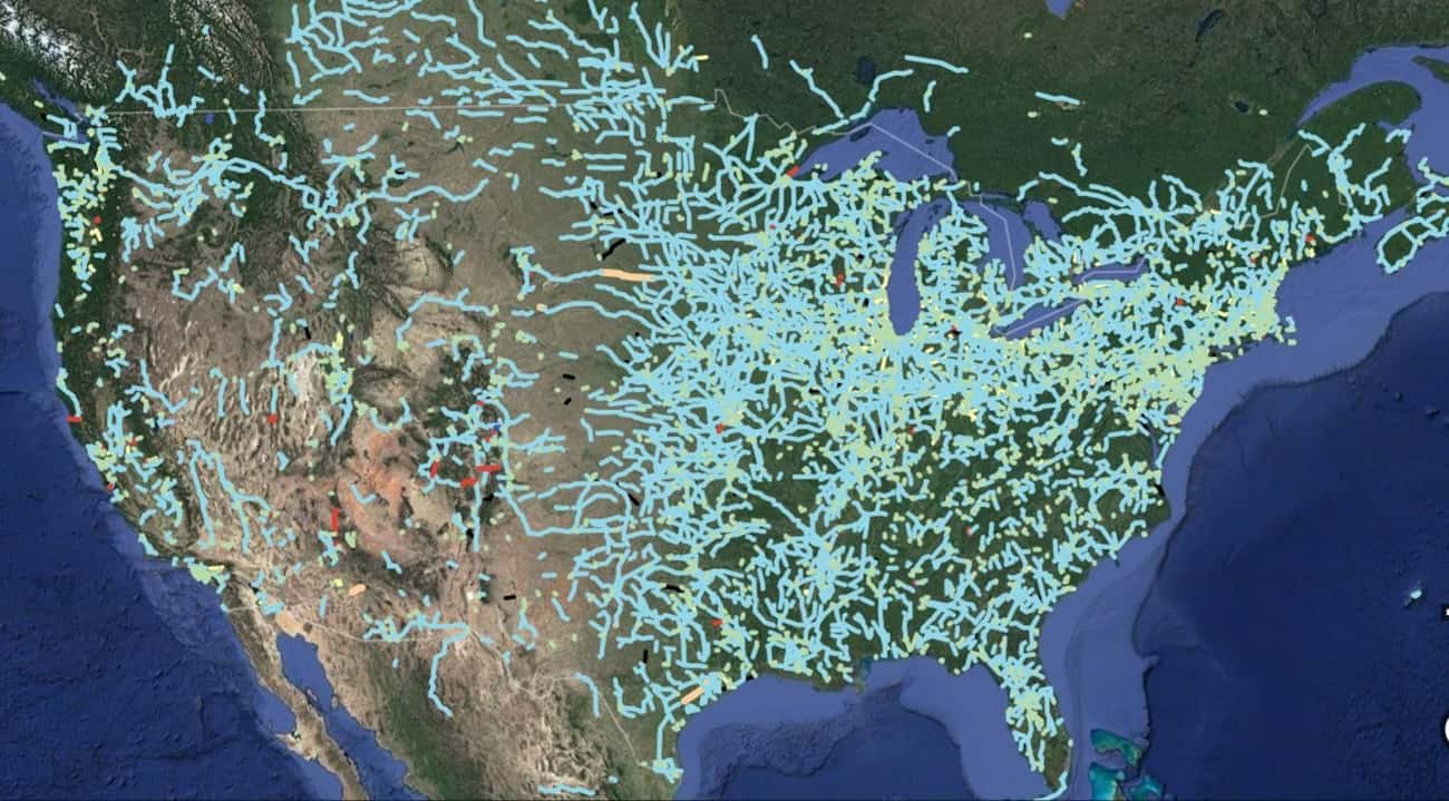
Photo: u/SwiftOryx / Reddit5. Out Of Service Railways
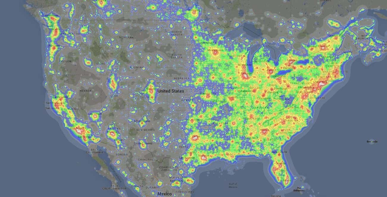
6. Light Pollution From Coast To Coast
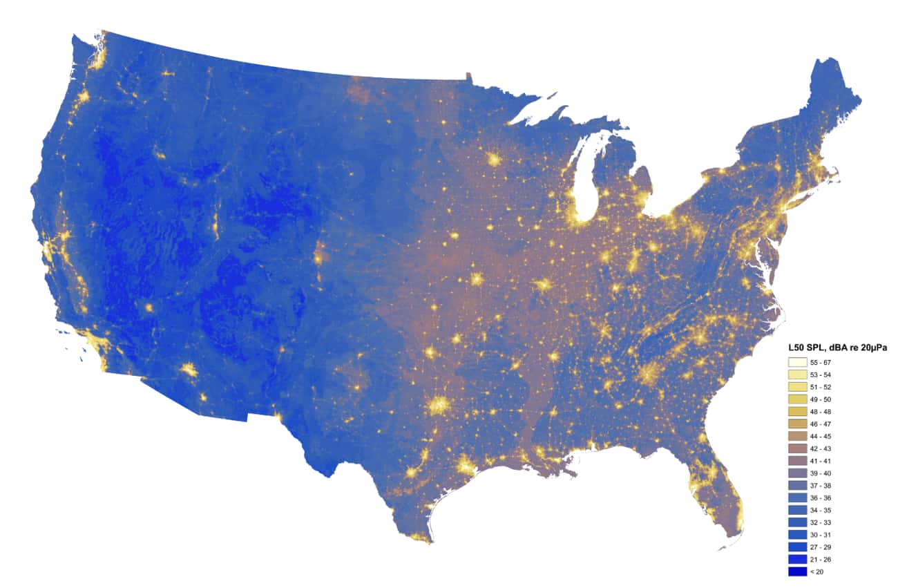
Photo: u/there_is_no_try / Reddit7. The Loudest And Quietest Spots In The Continental US
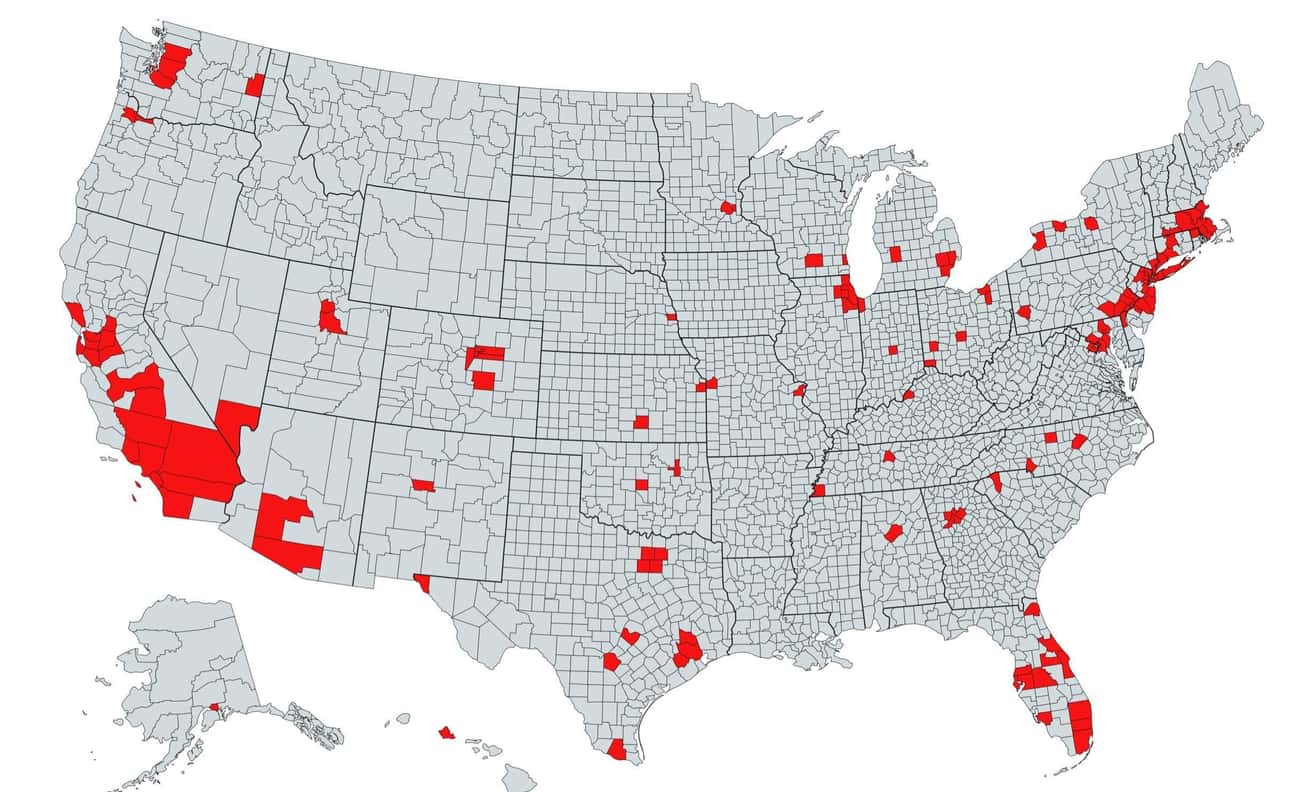
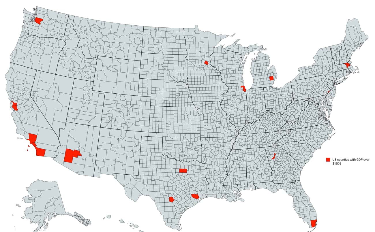
Photo: National Park Service8. Counties With A GDP Over $100 Billion
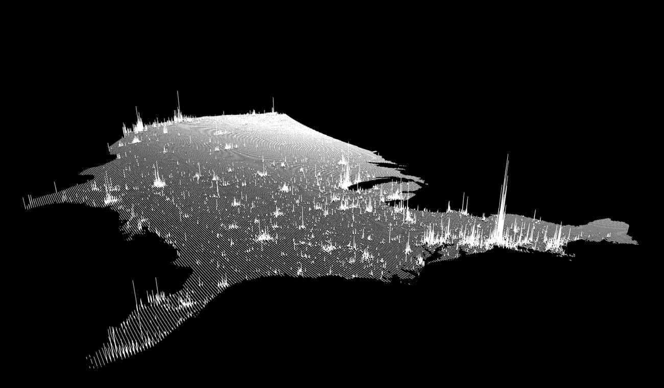
Photo: u/im_sorry_wtf / Reddit9. Population Spikes From A New Angle
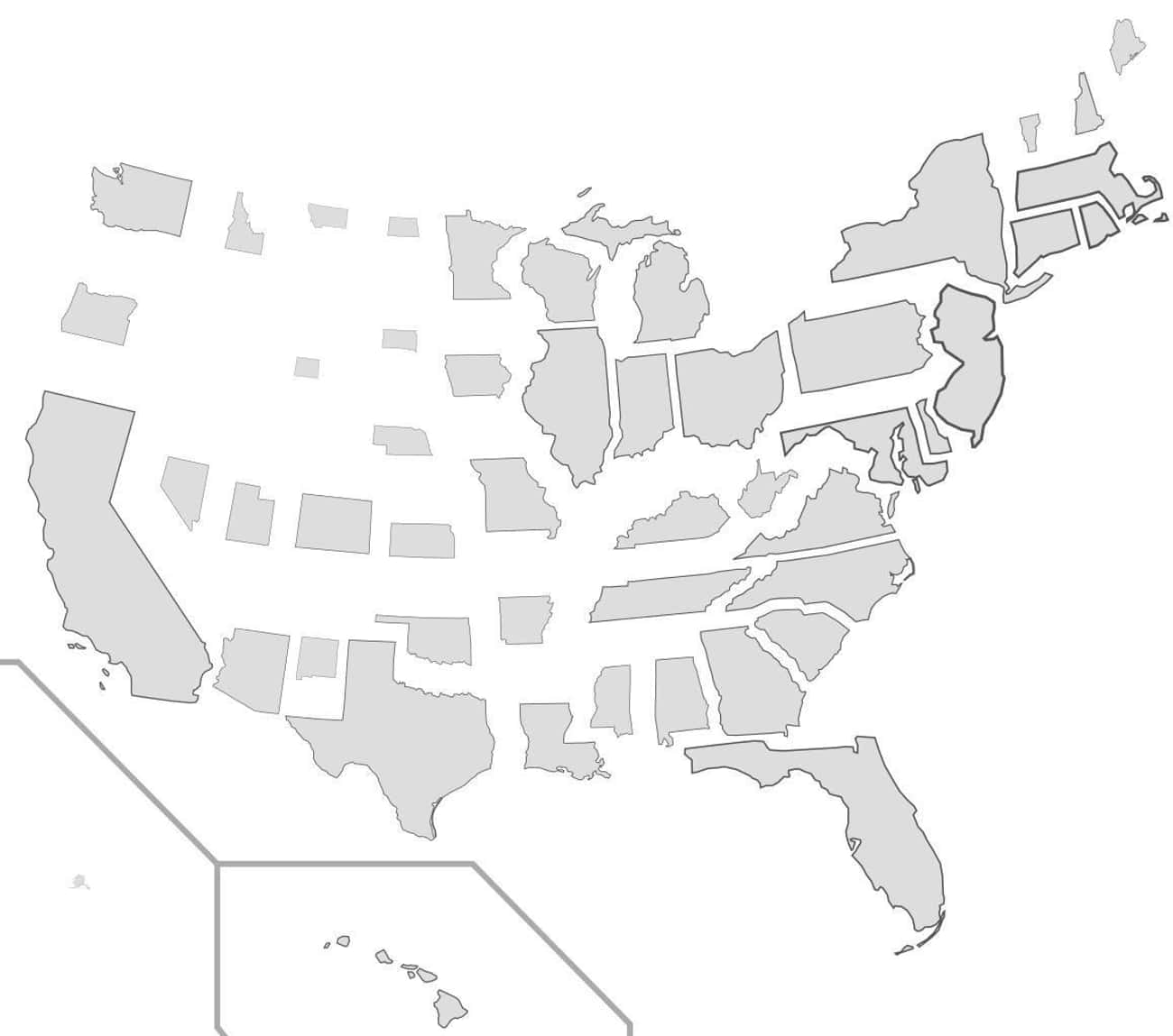
10. States Resized According To Population Density
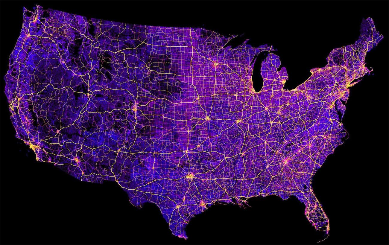
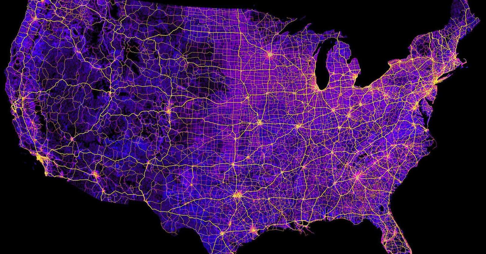
Photo: u/StarboardCapsized / Reddit11. 8 Million Miles Of Highways And Roads
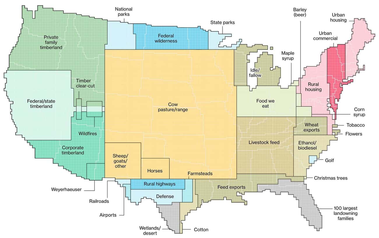
Photo: u/SkyHawk2112 / Reddit12. Land Use Illustrated
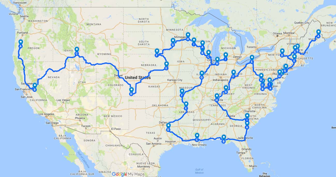
Photo: u/Al-Andalusia / Reddit13. The Most Efficient Road Trip Through Every Springfield In The Country
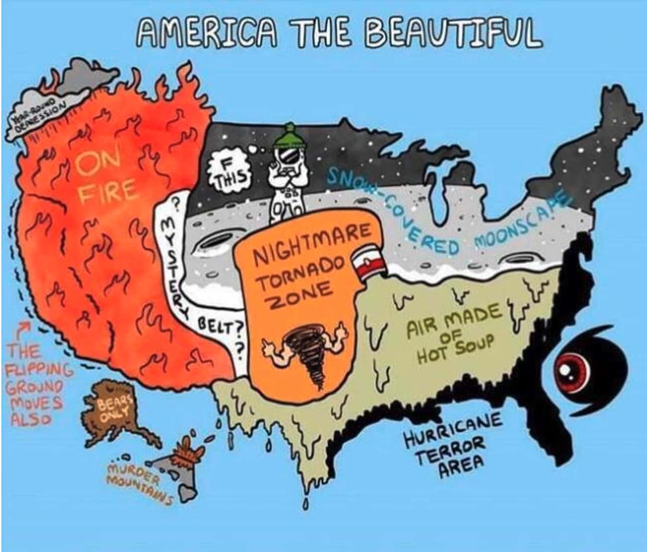
Photo: u/GreenMobius / Reddit14. Dominant Regional Weather Types
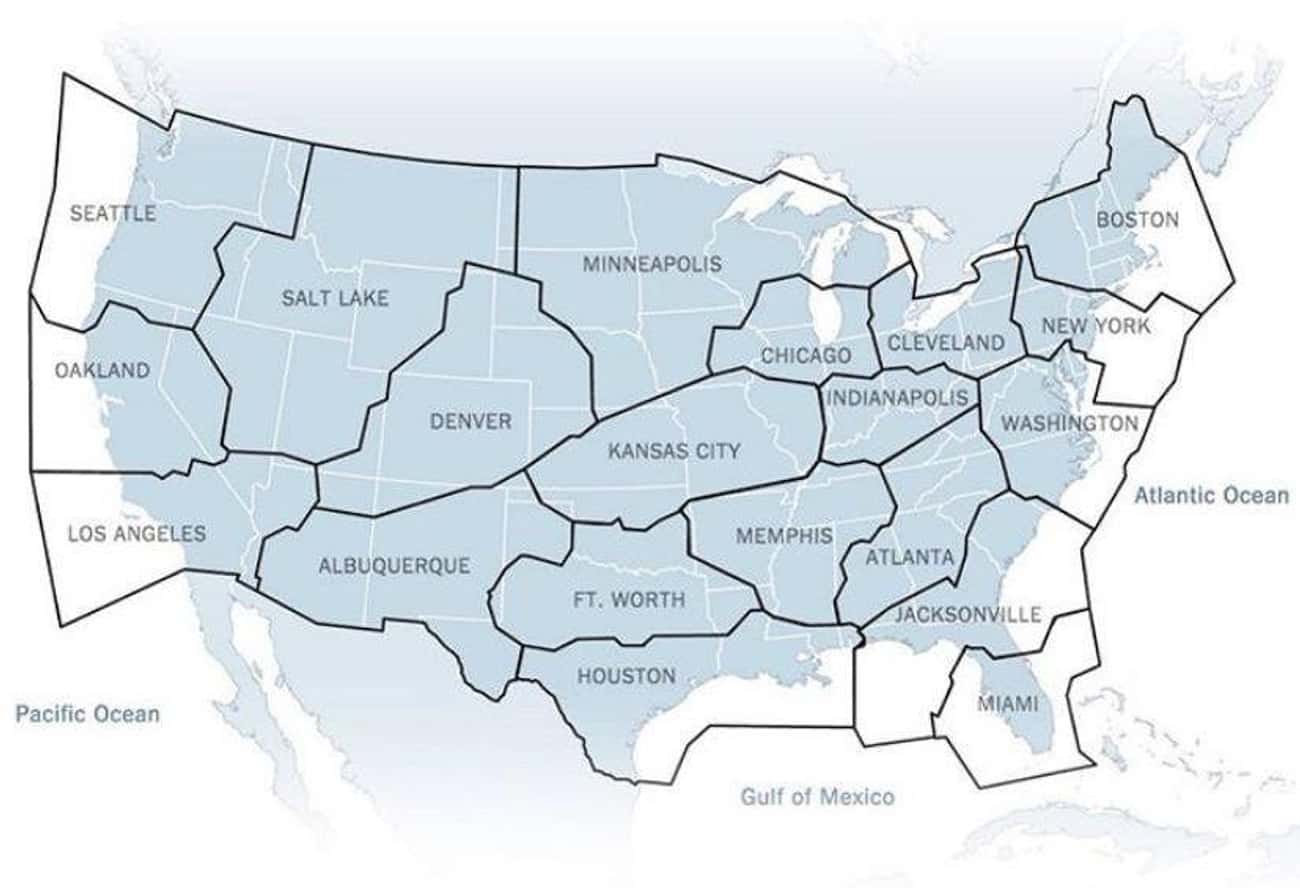
Photo: u/Yosemite_Scott / Reddit15. Broken Up By Air Traffic Control Zones
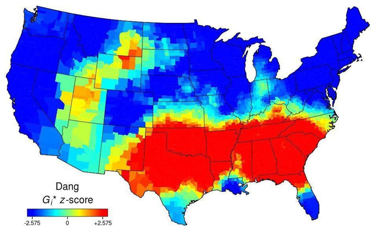
Photo: u/lucyeeliza / Reddit16. Use Of The Word "Dang" Across The Continental US
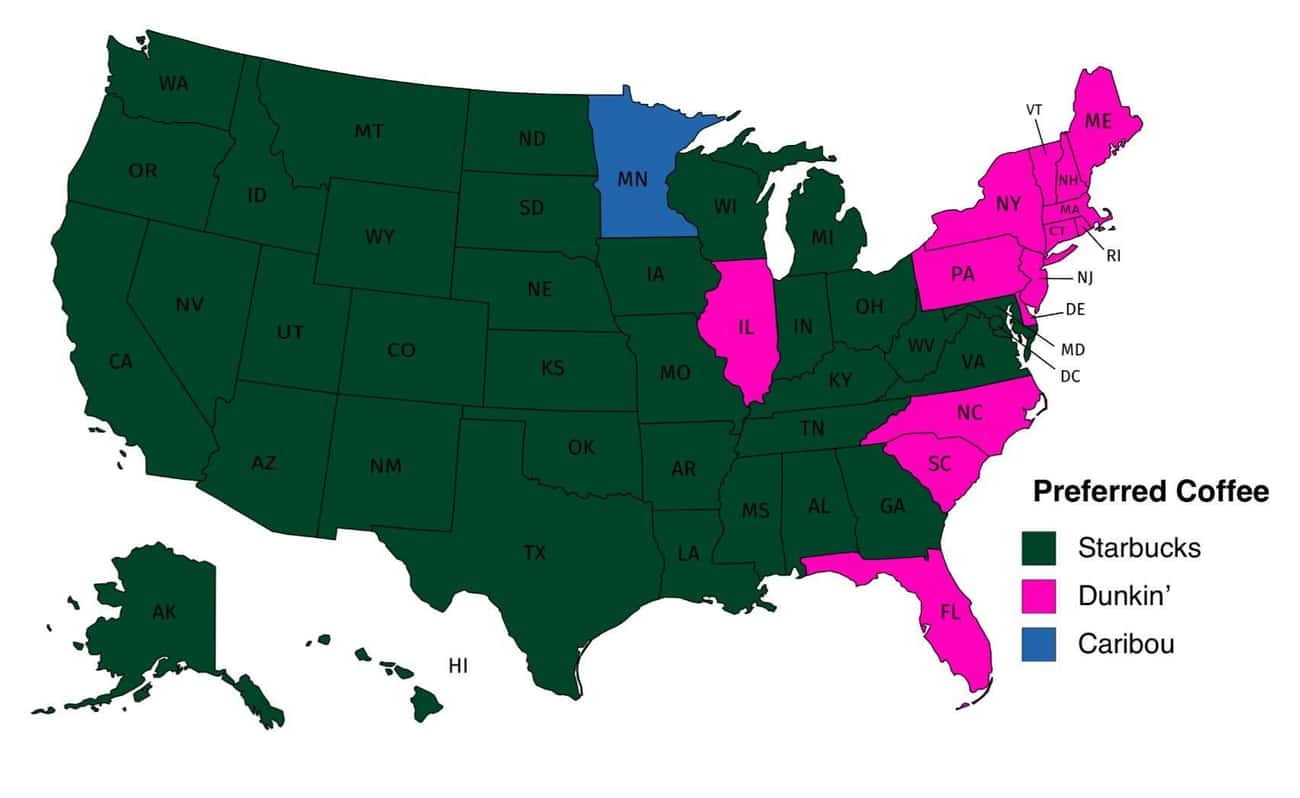
17. Popular Coffee Shop Chains By Number Of Locations
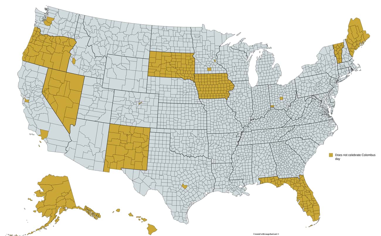
Photo: u/dannywat3rm3lon / Reddit18. Regions That Do Not Officially Celebrate Columbus Day